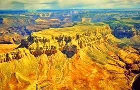
Geomorphology focuses on the origin/evolution of landforms and the physical processes responsible for their creation and modification. This course is structured to begin with the “big picture” view of geomorphology (whole-earth shape, large- scale details of the continents and oceans). It is the outcome of this course that, by the end, students will understand the relationship between numerous Earth’s surface landforms and the processes responsible for creating and shaping them.
- Teacher: Tr Geog 006
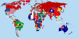
Political Geography is a part of Human Geography. It is studied on the spatial analysis of political process and it concerns the connection between politics and geography. By studying this course, the student will get some skills such as using information related to political geography to differences between countries, and studying the relationship between the power of the state and the strength of its economy. And then, student will get analyzing the relationship between topics of political geography.
- Teacher: Tr Geog 006
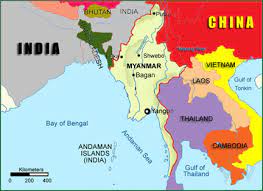
Geography of Myanmar is a course designed to explore the physical and human geography of Myanmar that have achieved high levels of economic development. In this course, students will learn about the physical, political, economic, social, and environmental characteristics of Myanmar, as well as the historical and cultural factors that have contributed to their development. Throughout the course, students will be encouraged to think critically and creatively about the complex challenges facing Myanmar.
- Teacher: Tr Geog 006
Agricultural geography includes in human geography and it is a branch of economic geography. Agricultural Geography is studied the spatial variations, distribution and location of agricultural activities on the earth's surface . This course covers the spatial variations and distribution of agricultural activities. After the end of this course, student will evaluate the spatial variation and distribution of crops, livestock and other agricultural activities in the world.
- Teacher: Tr Geog 006

Application
of Geospatial Technology in Geographical Analysis :-Geospatial technologies is an
umbrella phrase associated with a suite of technologies including remote
sensing(RS), Global Positioning System (GPS), Geographic Information System
(GIS), information technologies (IT), and field sensors that help in
capturing/storing/processing / displaying/disseminating information tied to a
particular location. Throughout the course, students will
be read,
interpret, and generate maps and other geographic representations as well as
extract, analyze, and present information from a spatial perspective.
- Teacher: Tr Geog 006
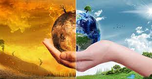
Impact of Climate Change :- Climate change is the very importance issues in the 21st century. The impacts of climate change effect on human society and the physical environment. In this course, impacts of climate change on both society and the physical environment are studied. The course will be examination of how climate change and its impacts on the human society and natural environment. After studying this course, students should be able to discuss the concept of climate change, to understand the physical basis of the natural greenhouse effect, human activities are increasing the gases in the atmosphere, and to consider the effects of climate change on extreme weather.
- Teacher: Tr Geog 006